


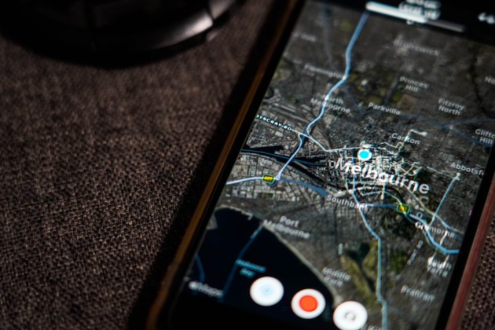
GPS is amazing. It helps your phone find the pizza place. It guides planes, ships, cars, hikers, and lost friends. But GPS has one funny weakness. It does not like walls, roofs, tunnels, caves, basements, or deep mines. Walk indoors, go underground, or enter a dense city block, and GPS may shrug like a confused tourist.
TLDR: GPS denied navigation helps machines and people know where they are when satellite signals are weak or missing. It uses sensors, maps, radio signals, cameras, and smart math to estimate position. This makes indoor and underground navigation possible in places like malls, mines, hospitals, tunnels, and warehouses. It is like giving your device a backup brain when GPS goes on vacation.
Why GPS Stops Working Indoors
GPS works by listening to satellites in space. These satellites send signals down to Earth. Your device catches those signals and calculates where it is.
That sounds simple. But the signals are very weak by the time they reach us. They travel a long, long way. A roof can block them. Concrete can weaken them. Metal can bounce them around. Tunnels can stop them completely.
So, when you walk into a building, GPS gets nervous. It may show you on the wrong side of the street. It may freeze. It may jump around. It may say you are inside a fountain. You are not. Probably.
This is where GPS denied navigation comes in.
GPS denied navigation means finding position without reliable GPS. It is also called alternative navigation or resilient navigation. The goal is simple. Keep knowing where you are, even when satellites cannot help.


The Big Idea: Use Clues Like a Detective
Imagine you are in a huge museum. Your GPS is useless. But you still have clues.
- You know where you entered.
- You know how many steps you took.
- You know when you turned left.
- You see signs on the wall.
- You pass Wi Fi routers.
- You see rooms, doors, and hallways.
A GPS denied system does the same thing. It collects many small clues. Then it combines them. One clue may be weak. Many clues together can be strong.
It is like making soup. A carrot alone is not soup. A potato alone is not soup. But mix vegetables, water, salt, and heat, and suddenly you have lunch. Navigation works the same way. Sensors become useful when combined.
Sensor Fusion: The Navigation Smoothie
The magic phrase is sensor fusion. It means mixing data from different sensors to get a better answer.
A phone, robot, drone, or vehicle may use many tools at once. Each tool has a job. Each has strengths. Each also has silly weaknesses.
- Accelerometers measure motion and speed changes.
- Gyroscopes measure turning and rotation.
- Magnetometers act like digital compasses.
- Cameras recognize walls, corners, signs, and objects.
- LiDAR scans shapes using laser light.
- Wi Fi signals help estimate location inside buildings.
- Bluetooth beacons provide nearby location markers.
- Ultra wideband gives accurate short range positioning.
- Barometers estimate floor level by air pressure.
One sensor might make a small error. Another sensor may correct it. A camera can help when a compass is confused. Wi Fi can help when step counting drifts. A map can stop a system from thinking you walked through a wall. Unless you are a ghost. Most users are not.
Inertial Navigation: Counting Moves Like a Robot
One of the oldest methods is inertial navigation. It uses motion sensors to track movement from a known starting point.
Let us say a firefighter enters a building. The system knows the entry door. The firefighter walks forward, turns right, climbs stairs, then turns left. Sensors track these moves. The system estimates the current position.
This method is useful because it does not need external signals. It works in tunnels. It works in smoke. It works when radio signals are weak.
But there is a catch. Small errors grow over time. If the system slightly miscounts each step, the final position can drift. After a while, the estimate may be wrong.
That is why inertial navigation is often paired with other tools. It is a good runner. But it needs a coach.
Wi Fi Positioning: Finding Yourself With Routers
Many buildings already have Wi Fi. That makes Wi Fi positioning popular.
Your device can measure nearby Wi Fi signals. It checks signal strength. It sees which routers are visible. Then it compares that pattern to a known map.
This is often called fingerprinting. Not finger fingerprinting. Signal fingerprinting.
For example, near the coffee shop, your phone may see routers A, B, and C. Near the elevator, it may see routers B, D, and F. Each spot has a different signal pattern. The system learns these patterns. Then it can guess your location.
Wi Fi is useful in malls, airports, hospitals, campuses, and offices. It is not always super precise. But it can be good enough to guide you to Gate 22, Room 410, or the nearest snack machine. This is important science.
Bluetooth Beacons: Tiny Location Lighthouses
Bluetooth beacons are small devices that send simple radio signals. They do not need to know who you are. They just shout, “I am here!” over and over.
Your phone listens. If it hears Beacon 12 loudly, you are probably close to Beacon 12. If it hears Beacon 20 weakly, you are probably farther away.
Beacons are popular for indoor navigation because they are cheap and easy to place. A museum can put them near exhibits. A hospital can place them near corridors. A warehouse can put them near shelves.
They are like tiny invisible breadcrumbs. But cleaner. And less likely to attract birds.
Image not found in postmetaUltra Wideband: The Indoor Ruler
Ultra wideband, or UWB, is a radio technology that can measure distance very accurately. It sends short pulses. Then it measures how long signals take to travel.
Because radio waves move at a known speed, timing gives distance. With several UWB anchors in a building, a tag can calculate its position.
UWB is often more accurate than Wi Fi or Bluetooth. It can locate items within centimeters in good conditions. That is very handy.
Factories use it to track tools. Warehouses use it to track forklifts. Hospitals can use it to find equipment fast. Nobody wants to spend twenty minutes hunting for a medical device that is hiding behind a curtain.
Vision Navigation: Letting Machines Use Their Eyes
Cameras can also help with indoor and underground positioning.
A system can look at its surroundings and compare what it sees to a map. It can detect corners, doors, pipes, signs, floor patterns, and lights. Robots often use a method called visual SLAM.
SLAM means simultaneous localization and mapping. Big phrase. Simple idea.
The robot builds a map while also figuring out where it is on that map. It is like drawing a maze while walking through it. Brave. Slightly stressful. Very clever.
Vision navigation can be powerful. But it needs light. It can struggle in smoke, dust, darkness, or blank hallways. A white hallway with no features is basically a robot’s nightmare. It looks like a long bowl of vanilla yogurt.
LiDAR: Painting the World With Lasers
LiDAR is another powerful tool. It sends laser pulses and measures how long they take to bounce back. This creates a 3D picture of the surroundings.
LiDAR can help robots, drones, and vehicles understand walls, tunnels, machines, shelves, and obstacles. In underground mines, it can map passages. In subway tunnels, it can inspect tracks. In warehouses, it can help robots avoid people and pallets.
LiDAR does not need GPS. It needs surfaces to scan. It works well in many dark places too, because it brings its own laser light. Tiny laser superpower? Yes.
Magnetic Positioning: Using Invisible Building Fingerprints
Buildings have strange magnetic patterns. Steel beams, elevators, machines, wires, and pipes all affect Earth’s magnetic field.
These patterns can become a kind of indoor fingerprint. A phone can measure magnetic strength in different spots. Then it can match those readings to a magnetic map.
This method is clever because it does not require many extra devices. The building already has magnetic quirks. The system simply uses them.
Of course, magnets can be moody. A new machine or metal shelf can change the pattern. Still, magnetic positioning can support other methods and improve accuracy.
Maps Matter More Than You Think
A map is not just a pretty picture. It is a rulebook.
If a navigation system knows the building layout, it can avoid impossible answers. You probably did not walk through a concrete wall. You probably used a hallway. You probably did not teleport from floor two to floor six. Unless the elevator was involved.
Indoor maps can include:
- Rooms
- Hallways
- Stairs
- Elevators
- Doors
- Restricted areas
- Emergency exits
- Equipment zones
When sensor data and maps work together, positioning gets better. The system can “snap” your location to a realistic path. This makes directions easier to follow.
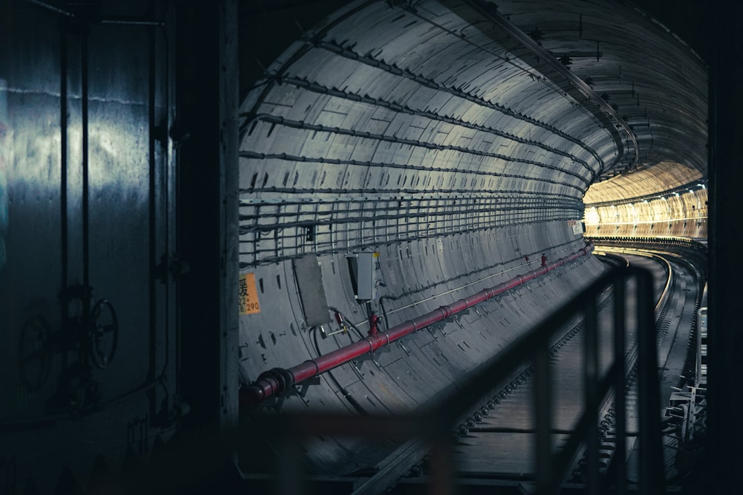
Underground Navigation: The Toughest Level
Indoor navigation is hard. Underground navigation is harder.
Underground spaces may have no GPS, no cellular signal, little Wi Fi, bad lighting, dust, water, rock, metal, and long tunnels that look the same. Basically, it is navigation on expert mode.
This matters a lot for mines, caves, bunkers, subway tunnels, utility tunnels, and underground construction sites.
In these places, GPS denied systems may use:
- Inertial sensors to track movement.
- LiDAR to map tunnel walls.
- UWB anchors placed in key areas.
- Radio nodes to create local positioning networks.
- Robotic mapping to update maps safely.
- Pressure sensors to measure depth changes.
For miners and rescue teams, this can be life saving. Knowing the location of people, vehicles, and hazards underground is not a luxury. It is safety.
Why This Technology Is So Useful
GPS denied navigation is not just for cool robots. It helps real people do real jobs.
Here are some simple examples.
- Hospitals: Staff can find patients, equipment, and rooms faster.
- Airports: Travelers can find gates, baggage areas, and shops.
- Warehouses: Robots can move products safely and quickly.
- Firefighting: Teams can track responders inside smoky buildings.
- Mining: Operators can locate workers and machines underground.
- Shopping malls: Visitors can find stores without wandering forever.
- Subways: Maintenance crews can inspect tunnels and equipment.
- Military and security: Teams can navigate when GPS is jammed or blocked.
It also helps autonomous machines. A robot cannot stop and say, “Sorry, I lost GPS.” That would be rude. And maybe expensive. Robots need reliable positioning to move safely.
The Challenge: No Single Perfect Tool
There is no magic indoor GPS button. Each method has tradeoffs.
- Wi Fi is common, but accuracy can vary.
- Bluetooth is cheap, but beacons need placement and maintenance.
- UWB is accurate, but needs special hardware.
- Cameras are rich in detail, but need good visibility.
- LiDAR is powerful, but can cost more.
- Inertial sensors work anywhere, but drift over time.
That is why modern systems combine tools. The best answer is usually a team effort. Like a band. The drummer alone is not the concert. The singer alone is not the concert. Add guitar, bass, keyboard, and snacks, and now we are ready.
The Future: Smarter, Smaller, and Everywhere
GPS denied navigation is getting better fast. Sensors are becoming smaller. Chips are becoming cheaper. Maps are becoming smarter. Artificial intelligence is helping systems recognize places and correct errors.
Future buildings may have positioning built in from the start. Emergency teams may see live indoor maps. Delivery robots may glide through complex buildings. Underground vehicles may map new tunnels as they drive. Your phone may guide you right to a product on a specific shelf.
One day, “I got lost in the hospital” may sound old fashioned. Like dial up internet. Or printing directions from a website.
Final Thought
GPS denied navigation is about giving location technology a backup plan. When satellites disappear behind concrete, rock, steel, or dirt, other tools step up.
They listen to radio signals. They count steps. They scan walls. They read maps. They use cameras and lasers. They combine clues like tiny digital detectives.
The result is simple and powerful. People, robots, vehicles, and tools can know where they are indoors and underground. GPS may be the star of outdoor navigation. But inside buildings and below the surface, GPS denied navigation takes the spotlight.
And that is how we stop getting lost in giant buildings, spooky tunnels, and confusing parking garages. Which, honestly, is a win for everyone.